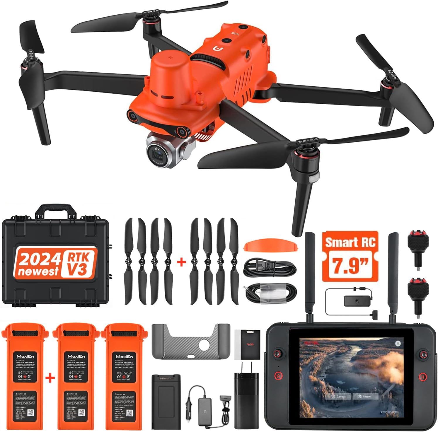
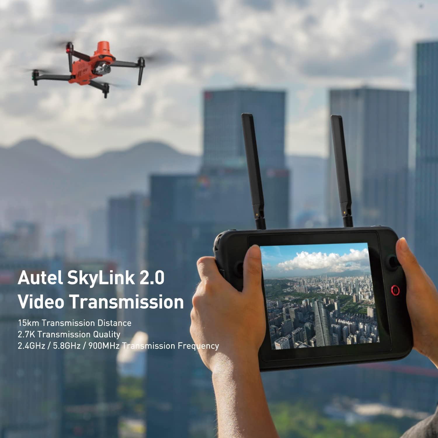
Have you been searching for a high-quality, advanced drone for mapping, photogrammetry, urban planning, or searching tasks? Look no further than the Autel Robotics EVO II PRO RTK V3. This drone is packed with features such as real-time centimeter-level positioning, remote ID, S-ony 1” 6K/30fps HDR camera, GNSS base station & PPK support, 38 minutes of flight time, and 15KM transmission range, making it a versatile and powerful tool for a wide range of professional applications.
Superior Positioning Accuracy
When it comes to precision, the Autel Robotics EVO II PRO RTK V3 truly shines. The integration of the newest RTK module allows for real-time centimeter-level positioning accuracy, with 1 cm + 1 ppm horizontally and 1.5 cm + 1 ppm vertically. This level of accuracy ensures that you can capture detailed and highly precise data for your mapping or photogrammetry projects.
RTK Base Station and Network Support
The EVO II PRO RTK V3 is equipped to support both RTK base stations and RTK networks, providing stable and accurate data acquisition even in complex operating environments. This feature is essential for ensuring that your drone can deliver precise positioning information consistently, no matter where your projects take you.
No Need for Ground Control Points
Thanks to its high-precision RTK module, the Autel EVO II PRO RTK V3 does not require traditional ground control points for accurate data collection. This makes the drone more flexible and efficient to use, as it is not limited by communication links or network coverage. You can rely on the drone to deliver accurate results, even in challenging conditions.
Intelligent Mission Execution
The Autel EVO II PRO RTK V3 offers advanced intelligence features that streamline mission execution and make your workflow more efficient. After creating a flight route using tasks such as Waypoint, Rectangle, Polygon, or Oblique Photography, the drone can fly autonomously on the designated flight path. This allows for smoother and more precise data collection.
Record Previous Shooting Positions
For repeatable data acquisition missions, the EVO II PRO RTK V3 allows you to record the drone’s previous shooting positions. This means that all the gimbals, camera movements, and aircraft movements are replicated, providing a comprehensive record of the entire mission. This feature is invaluable for tasks that require precise and consistent data collection.
High-Precision GNSS Base Station
To further enhance its precision and accuracy, the Autel EVO II PRO RTK V3 supports a high-precision GNSS base station for obtaining real-time differential data. This feature allows you to obtain the accurate coordinates of your designated target point, ensuring that your data is reliable and consistent.
Environmental Adaptability
Whether you are working on mapping, firefighting, search and rescue, law enforcement, power inspection, traffic supervision, or environmental protection projects, the Autel EVO II PRO RTK V3 is up to the task. Its flexibility and adaptability make it an ideal choice for a wide range of missions and fields, allowing you to tackle diverse challenges with ease.
Wide Application Compatibility
The EVO II PRO RTK V3 is compatible with a variety of applications, making it a versatile tool for professionals in different industries. From creating surfaces, point clouds, and orthoimages with Carlson PhotoCapture to extracting features and generating CAD plans with Carlson Point Cloud, this drone offers accurate, durable, and user-friendly performance for numerous tasks.
Bundle Includes
To help you get started right away, the Autel EVO II PRO RTK V3 bundle includes everything you need for a successful mission. The package contains:
- EVO II Pro RTK V3 Aircraft x1
- V3 Smart Controller x1
- Battery x3
- Propeller x4 pairs
- Gimbal Cover x1
- Battery Charger & Power Cable x1
- Car Charger x1
- Multi-Charger x1
- RC Charger x1
- RC Charging Cable x1
- Spare Control Stick x1 pair
- RC Protective Case x1
- RC Lanyard x1
- Extended Port Cover x1
- Protector Case x1
If you have any further questions about the Autel Robotics EVO II PRO RTK V3, feel free to contact officialauteldrone@outlook.com for more information.
With its cutting-edge features, advanced technology, and unmatched precision, the Autel EVO II PRO RTK V3 is a top-of-the-line drone that is sure to elevate your professional projects to new heights. Invest in this powerful tool today and experience the difference firsthand.
Disclosure: As an Amazon Associate, I earn from qualifying purchases.


